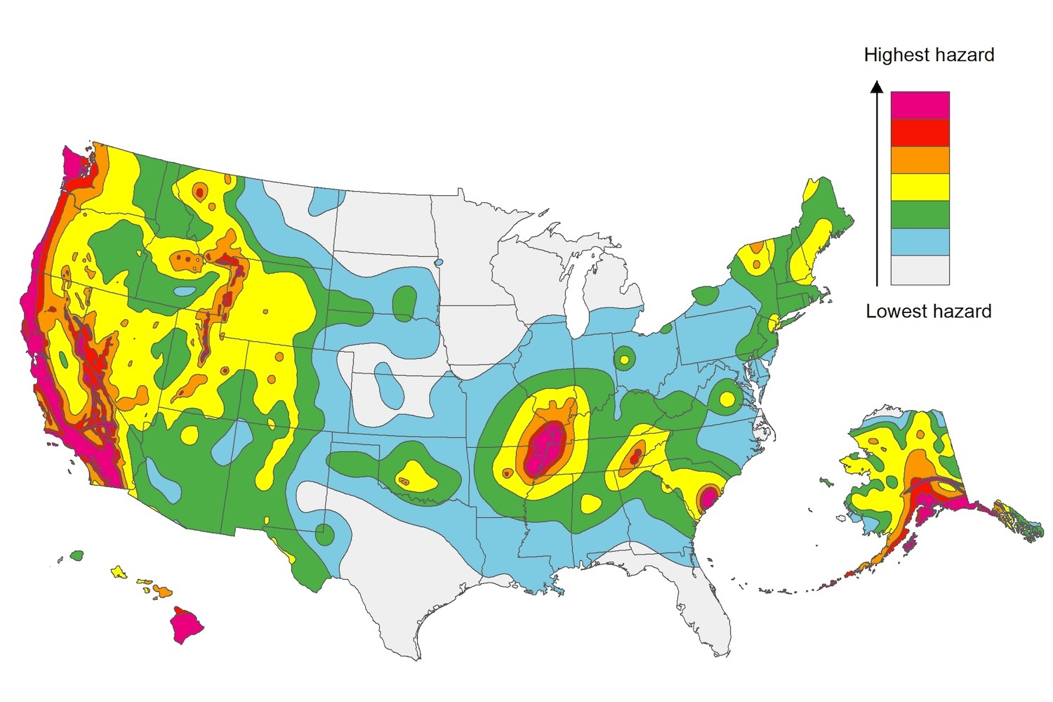
The U.S. Geological Service recently released an update of U.S. National Seismic Hazard Maps that reflect the latest analysis of where future earthquakes will occur, how frequently they may occur, and their strength.
While all states have some potential for earthquakes, 42 of the 50 states have a reasonable chance of experiencing damaging ground shaking from an earthquake in the next 50 years. Sixteen states have a relatively high likelihood of experiencing damaging ground shaking. These states have historically experienced earthquakes with a magnitude 6 or greater. The hazard is especially high along the west coast, intermountain west, and in several active regions elsewhere such as near New Madrid, Mo., and near Charleston, S.C.
The eastern U.S. has the potential for larger and more damaging earthquakes than considered in previous maps and assessments. This finding is due to what scientists learned following the magnitude 5.8 earthquakes that struck Virginia in 2011. It was among the largest earthquakes to occur along the east coast in the last century, and indicated that even larger events in the region are possible.
The maps are used in risk analyses calculated using factors such as population levels, building exposure, and building construction practices. These assessments are used for establishing building codes, in the analysis of seismic risk for key structures, and in determining insurance rates. They can also aid emergency preparedness plans, and private property decisions such as re-evaluating one’s real estate and making it more resilient.
(http://www.usgs.gov/blogs/features/usgs_top_story/new-insight-on-the-nations-earthquake-hazards/)
Related Stories
Codes and Standards | Apr 20, 2021
U.S. electric grid is halfway to zero carbon
Other sectors including buildings lag power industry.
Codes and Standards | Apr 19, 2021
Failed landmark preservation effort in Chicago provides lessons for planners
Gentrification fears heightened among Pilsen neighborhood residents doomed ambitious preservation plan.
Codes and Standards | Apr 14, 2021
New Phase 1 Environmental Site Assessment standard debuts in 2021
Will affect 250,000 commercial real estate deals a year.
Codes and Standards | Apr 13, 2021
British Columbia moves to accelerate mass timber construction
Province funds demonstration projects as part of economic recovery.
Codes and Standards | Apr 12, 2021
WoodWorks and Think Wood release first Mass Timber Design Manual
Interactive collection of information on mass timber products, design best practices, taller wood construction and sustainability.
Codes and Standards | Apr 8, 2021
Sensors used in tunable lighting systems found to have high reliability
DOE study investigated items used to control lumen depreciation, chromaticity shifts, and changes in drivers.
Codes and Standards | Apr 7, 2021
Red tape ruined the U.K.’s home retrofit program
Lessons learned could help US avoid that fate.
Codes and Standards | Apr 6, 2021
Lendlease achieves net-zero carbon in Boston, Chicago multifamily portfolio
New projects in New York, Los Angeles on track to reach goal.
Codes and Standards | Apr 5, 2021
Specification for sliding door, lift and slide roller assemblies updated
Addresses market trend toward heavy sliding doors.
Codes and Standards | Apr 5, 2021
Construction employment rebounds in March following February drop
Rising costs, supply-chain woes, and cancellations threaten outlook.


