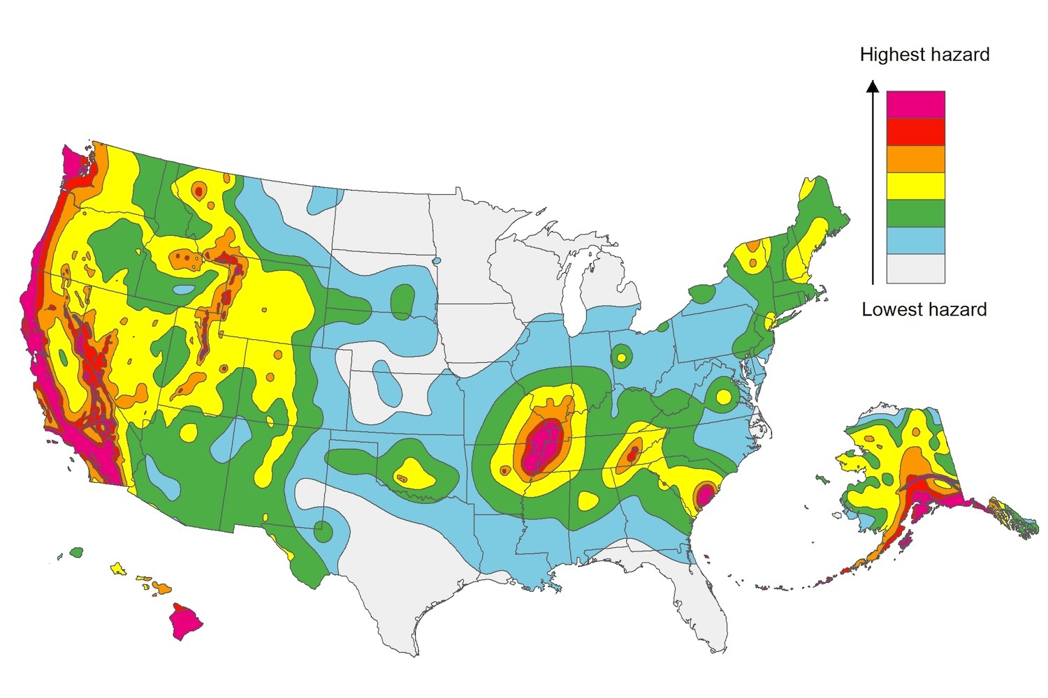
The U.S. Geological Service recently released an update of U.S. National Seismic Hazard Maps that reflect the latest analysis of where future earthquakes will occur, how frequently they may occur, and their strength.
While all states have some potential for earthquakes, 42 of the 50 states have a reasonable chance of experiencing damaging ground shaking from an earthquake in the next 50 years. Sixteen states have a relatively high likelihood of experiencing damaging ground shaking. These states have historically experienced earthquakes with a magnitude 6 or greater. The hazard is especially high along the west coast, intermountain west, and in several active regions elsewhere such as near New Madrid, Mo., and near Charleston, S.C.
The eastern U.S. has the potential for larger and more damaging earthquakes than considered in previous maps and assessments. This finding is due to what scientists learned following the magnitude 5.8 earthquakes that struck Virginia in 2011. It was among the largest earthquakes to occur along the east coast in the last century, and indicated that even larger events in the region are possible.
The maps are used in risk analyses calculated using factors such as population levels, building exposure, and building construction practices. These assessments are used for establishing building codes, in the analysis of seismic risk for key structures, and in determining insurance rates. They can also aid emergency preparedness plans, and private property decisions such as re-evaluating one’s real estate and making it more resilient.
(http://www.usgs.gov/blogs/features/usgs_top_story/new-insight-on-the-nations-earthquake-hazards/)
Related Stories
Codes and Standards | Dec 21, 2021
Outdated and redundant building codes plague St. Louis area development
Region’s combined codes nearly double the length of the IRS Code.
Digital Twin | Dec 20, 2021
Groups ally to advance augmented reality and digital twin technology
AREA and Digital Twin Consortium to work on improving how technology components interoperate.
Codes and Standards | Dec 20, 2021
Tension rises in California over state’s push to build more housing
Attorney general hints at lawsuits against cities that don’t comply with zoning reform.
Codes and Standards | Dec 17, 2021
Tension rises in California over state’s push to build more housing
Attorney general hints at lawsuits against cities that don’t comply with zoning reform.
Codes and Standards | Dec 16, 2021
Home builders defeat proposed Oklahoma energy conservation code upgrade
Builders cite high home prices for opposition.
Codes and Standards | Dec 16, 2021
Laws and regulations complicate growth of community solar gardens
New projects stymied by utility resistance and legislative restrictions.
Codes and Standards | Dec 16, 2021
Property owners need systematic approach to GHG emissions reduction
Energy hog buildings at risk for becoming stranded assets.
Codes and Standards | Dec 15, 2021
Design problems now the primary cause of construction claims and disputes
More likely to occur due to more tight timescales imposed upon third parties engaged in design.
Codes and Standards | Dec 13, 2021
ABC releases guide to technology for improving safety performance
Provides details on how to identify, choose, and implement technology.
Codes and Standards | Dec 8, 2021
Construction industry is the top target for cyberattacks
Smart building tech is a new avenue for criminals.


