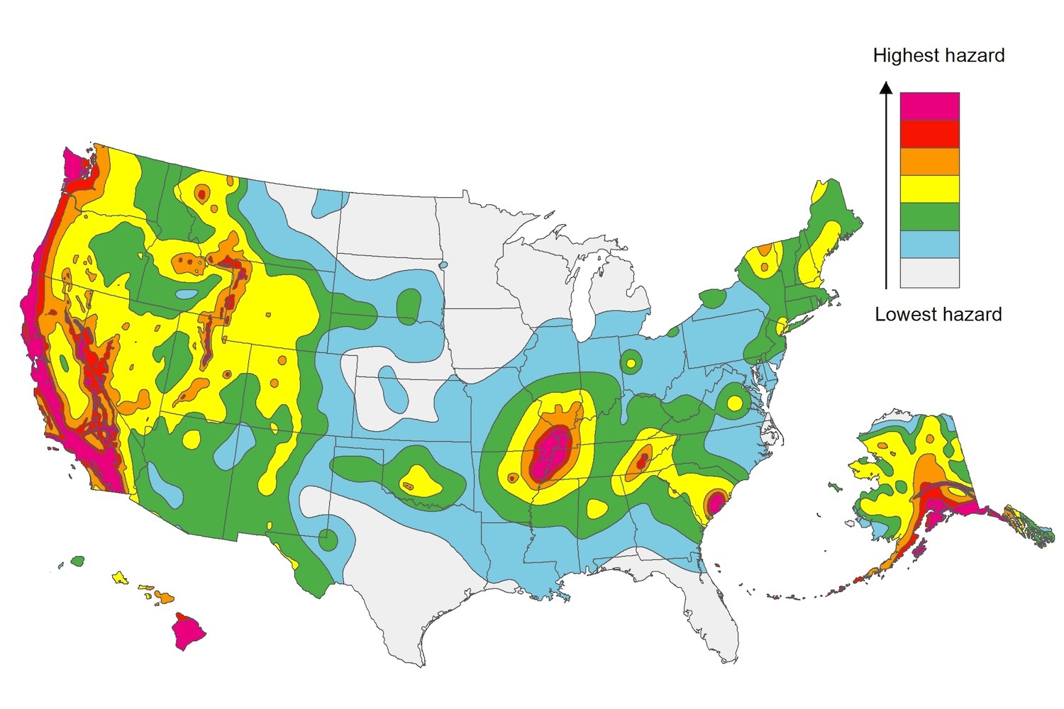
The U.S. Geological Service recently released an update of U.S. National Seismic Hazard Maps that reflect the latest analysis of where future earthquakes will occur, how frequently they may occur, and their strength.
While all states have some potential for earthquakes, 42 of the 50 states have a reasonable chance of experiencing damaging ground shaking from an earthquake in the next 50 years. Sixteen states have a relatively high likelihood of experiencing damaging ground shaking. These states have historically experienced earthquakes with a magnitude 6 or greater. The hazard is especially high along the west coast, intermountain west, and in several active regions elsewhere such as near New Madrid, Mo., and near Charleston, S.C.
The eastern U.S. has the potential for larger and more damaging earthquakes than considered in previous maps and assessments. This finding is due to what scientists learned following the magnitude 5.8 earthquakes that struck Virginia in 2011. It was among the largest earthquakes to occur along the east coast in the last century, and indicated that even larger events in the region are possible.
The maps are used in risk analyses calculated using factors such as population levels, building exposure, and building construction practices. These assessments are used for establishing building codes, in the analysis of seismic risk for key structures, and in determining insurance rates. They can also aid emergency preparedness plans, and private property decisions such as re-evaluating one’s real estate and making it more resilient.
(http://www.usgs.gov/blogs/features/usgs_top_story/new-insight-on-the-nations-earthquake-hazards/)
Related Stories
Codes and Standards | Oct 3, 2018
Climate change impacts could prompt realignment of assets for commercial property developers
Strategies include reducing exposure to properties in flood-prone areas.
Codes and Standards | Oct 2, 2018
Political will, tougher standards needed to reach carbon neutral goal
Stretch codes, more stringent credentials for designers, contractors, and inspectors may be needed.
Codes and Standards | Sep 27, 2018
Natural light is the most prized office perk
Employees crave sunshine and views of the outdoors more than cafeterias, fitness centers, and childcare.
Codes and Standards | Sep 26, 2018
Industry consensus needed for multifamily energy efficiency retrofit approach
Choice of insulating materials can impact indoor air quality, resident health.
Codes and Standards | Sep 25, 2018
New market forces disrupting global real estate development industry
Executives concerned about trade policy, labor shortages, approval processes.
Codes and Standards | Sep 21, 2018
More than 130 organizations petition OSHA to create heat protection standard for workers
Includes mandatory rest breaks, heat-exposure monitoring, record-keeping injury requirement.
Codes and Standards | Sep 20, 2018
North Carolina law banning use of recent climate science could worsen Hurricane Florence impact
Policies may have undermined ability to make coastal regions more resilient.
Codes and Standards | Sep 19, 2018
AIA endorses building owner participation in cap-and-trade programs
Would spur more energy conservation in buildings and cut carbon emissions.
Codes and Standards | Sep 18, 2018
ConsensusDocs Coalition publishes new Lean Addendum
Industry-first document to facilitate lean tools without need to sign multi-party IPD agreement.
Codes and Standards | Sep 14, 2018
IAPMO seeks comments on proposals for 2021 plumbing and mechanical codes
Deadline is Jan. 3, 2019.


