

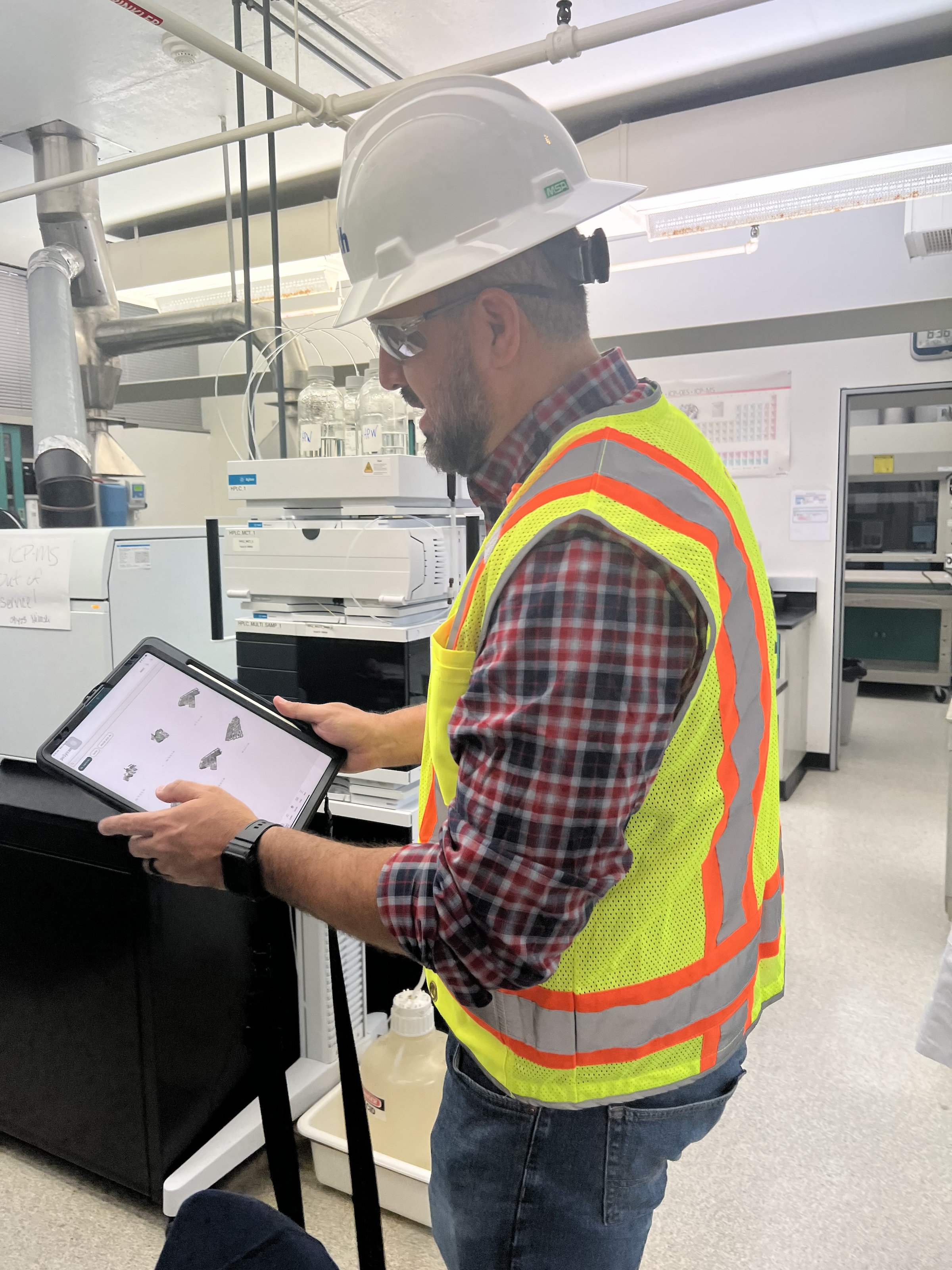
 in Virginia Beach, Va., used LIDAR and BIM technology to develop precise building and equipment data for a planned expansion of its Central Environmental Laboratory. Photo courtesy CDM Smith")
In the world of architecture and engineering, laboratory buildings are among the most complex buildings to design, plan, and document. Traditional methods rely on the use of photographs, hand drawings, or notes to document not only the building but also the equipment that makes up a laboratory. This makes the process difficult, tedious, time consuming, and even allows for documentation errors.
Currently, the most advanced state-of-the-art technology is combining Light Detection and Ranging (LIDAR) technology with Building Information Modeling (BIM) technology. LIDAR is a remote sensing method that uses light in the form of a pulsed laser to measure ranges to Earth. BIM is workflow process software used to model and optimize projects.
The latest LIDAR technology is available in the current version of hand-held devices that are used for field documentation. These devices come equipped with a very reliable LIDAR scanner, which allows one to easily document and scan in a point cloud all the existing conditions of the building like its space, function, and mechanical, electrical, and plumbing (MEP) needs.
Following the LIDAR scan, advanced software is deployed to transfer the data into a point cloud. This serves as a reliable reference to take measurements, to know where equipment is, and what its MEP needs are. Once in the point cloud, it is then exported into Autodesk ReCap Pro, and later to Autodesk Revit, which are BIM solutions.
Here it is not only inserted into the point cloud to corroborate measurements, locations and needs. It is also with the use of BIM technology and the use of special equipment families, that the foundations for the use of 7D Management of the laboratory equipment and MEP items can be developed into a 7D BIM Model.
A digital twin, which is a digital representation of a physical object or process in a digital version of its environment, can also be developed from this point. Digital twins can help an organization simulate real situations and their outcomes, ultimately allowing it to make better decisions.
LIDAR and BIM technology for building data collection
LIDAR and BIM technology such as Revit allows the existing conditions captured on site to be preserved in the digital model, allowing for measurements, orientation to aspects of the model, etc. without having to be physically on site, and more importantly, to have an orientation as to where each piece of equipment is and what the MEP needs are.
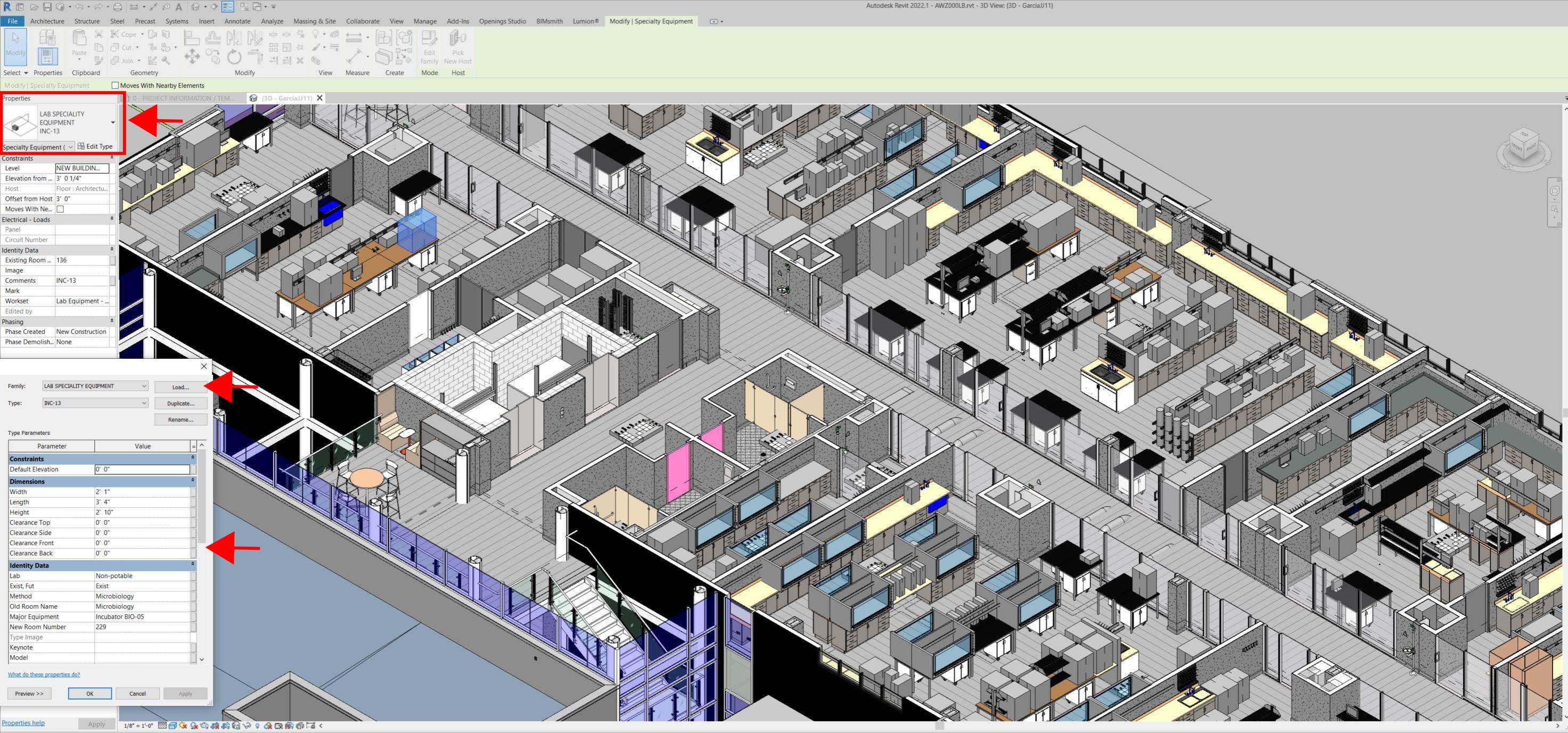
Even for any highly experienced architect or BIM modeler, just using photographs or hand drawings can be overwhelming and very complicated. Using this process, the Revit model serves as a replica of the existing conditions of each space and equipment. During a building expansion, being able to compare existing equipment in the new space is more accurate and easier to understand.
For example, Hampton Roads Sanitation District (HRSD) in Virginia Beach, Va., used LIDAR and BIM technology to develop precise building and equipment data for a planned expansion of its Central Environmental Laboratory.
The process involved meticulously scanning each space relevant to the project. This comprehensive scan aimed to capture every corner accurately. Following the scanning phase, the data was processed, generating a point cloud in ReCap Pro format. With the point cloud, we harnessed the advantages of LIDAR technology such as digitally acquiring existing conditions of the building and equipment, essentially providing a virtual on-site experience with just a click, eliminating the need for physical site visits.
This technology has enabled us to create detailed digital 3D families for every existing piece of equipment and its needs, as well as to capture more accurate existing conditions for the building. In the past, our approach relied solely on on-site measurements and photographs, leading to continuous errors and laborious, time-consuming tasks.
The previous method also necessitated numerous site visits for data verification. The implementation of this advanced technology and streamlined process has not only saved time and money but has also significantly enhanced our efficiency. For instance, all of that work required in the past to digitally model from notes, photographs, existing building plans, etc. has been condensed to the import and refinement of the point cloud data into the modeling environment.
Related Stories

Codes and Standards | Aug 22, 2019
5G expected to give a boost to construction technology
Virtual reality, Internet of Things, robotics, and drones will all benefit from enhanced data flows.

AEC Innovators | Aug 15, 2019
Oracle’s replica of a construction jobsite creates an immersive environment for AEC professionals
The Oracle Construction and Engineering Innovation Lab allows visitors to walk through five different stages of construction work, to test new AEC technologies and training techniques.

AEC Tech | Aug 14, 2019
ConTech VC discloses details about latest fund
Brick & Mortar Ventures has struck 16 deals in past 20 months.

AEC Innovators | Aug 9, 2019
Improving architectural designs through iteration
Computational design lets ZGF Architects see patterns that renderings and even models can’t show.

AEC Tech | Jul 29, 2019
2019 Bluebeam Extreme Conference: Peer-to-Peer Learning at Scale
XCON 2019 to focus on collaborative partnerships and what works in digital construction

Multifamily Housing | Jul 23, 2019
Is prefab in your future?
The most important benefit of offsite construction, when done right, is reliability.

AEC Tech | Jul 15, 2019
Lack of standards hampers development of exoskeleton industry
Guidelines, common terminology, and testing methodology are needed, says expert.

AEC Tech | Jul 15, 2019
Investors eye startups focused on automating construction
Investors could reap big payoffs in an industry that experts say is ready for automation.

AEC Tech | Jul 12, 2019
A new Dodge-Viewpoint report gauges how well contractors gather and use jobsite data
Information is power, but are contractors collecting what they need to make better decisions?

| Jul 11, 2019
Pepper Construction is using 3D models to help identify underground utilities on jobsites
Overlaying new installs and site surveys add precision to the construction process.


