

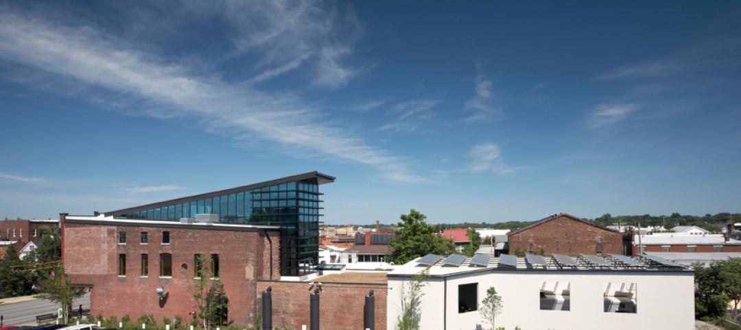
The terms “desire path” and “line of desire” bring with them a bit of a mystical feeling, as if they were something Indiana Jones would need to find a way to cross to get to the Ark of the Covenant or the Holy Grail that awaits on the other side. In reality, desire paths are not quite so fantastical.
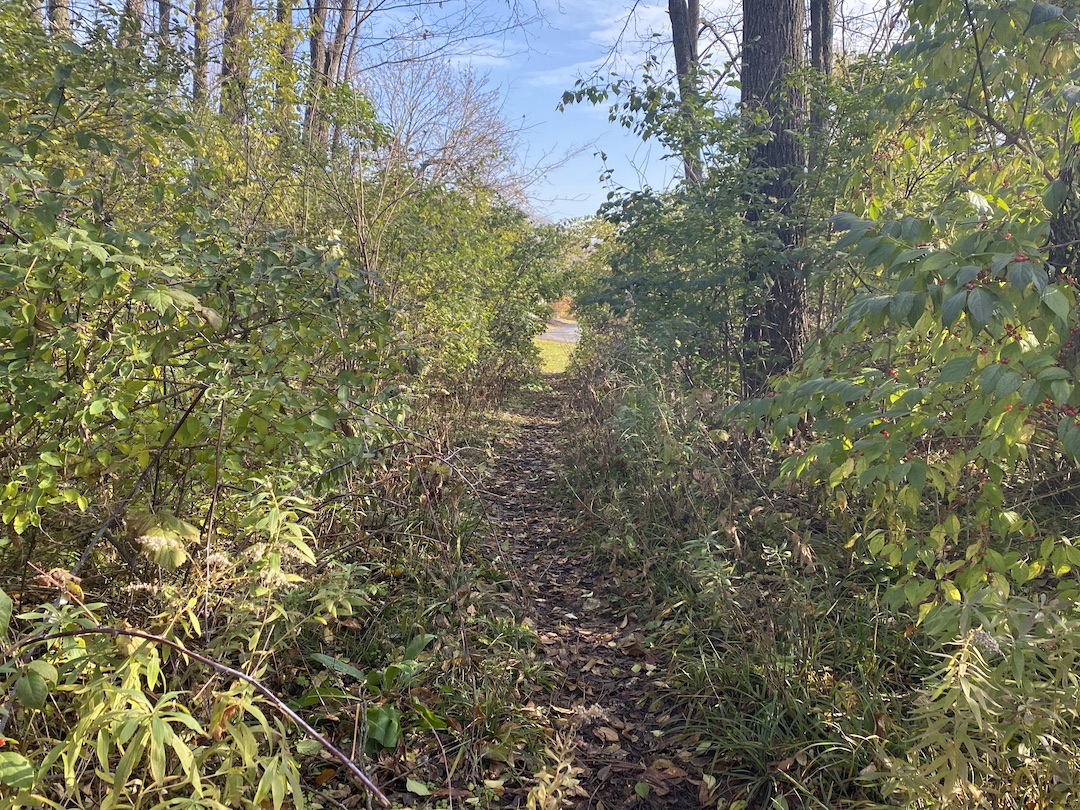
Even if you have never heard the term desire path, odds are you’ve seen one at some point. If you’ve ever been walking around a college campus, public park, or downtown area, you have probably seen an informal dirt path that cuts a corner, or through a field, or even through a few small shrubs or bushes. This path isn’t paved and clearly wasn’t part of the original plan, but thanks to the desire of many to find the path of least resistance from point A to point B, it has emerged over the years from repeated use.
Desire paths don’t necessarily have to be so rustic, either. Lines of desire can also be represented by people using formalized roads or paths in ways they were not intended to be used, such as a service road that has become a main pedestrian thoroughfare.
In general, a desire path or line of desire represents any path that end users have determined to be the most efficient way to travel, regardless of its intended use.
“They reflect the natural tendency of where people want to move. These lines are predicated on there being barrier-free environments,” says Caitlyn Clauson, Principal, Chair at Large on Board of Directors, and Planner at Sasaki. “If areas are inaccessible, for example with a steep slope or a discontinuous sidewalk, individuals will find other routes. Desire lines are often informed by adjacent land uses, especially uses with active ground floor functions and high levels of transparency and shade that make spaces inviting and habitable.”
For many, especially planners and designers, a desire path is an unsightly reminder that a campus or downtown design plan was not as efficient and pedestrian-friendly as it could have, or perhaps should have, been. It proves just because something was designed to function a certain way, it doesn’t mean end users will necessarily follow suit.
There are two solutions to the scourge of the desire path: find a way to create a space so optimally designed desire paths won’t ever rear their ugly heads, or create a space so flexible that if a desire path does appear, it can be formalized and integrated into the design.
Sasaki’s CoMap helps spot ‘desire paths’ before they start
In order to prevent desire paths from taking shape, they need to be taken into consideration during a project’s earliest phases. “We did a feasibility study for UC San Diego in 2019 involving some developer land adjacent to campus and the campus architect was intrigued by my use of the term ‘line-of-desire’ in our initial meeting,” says Paul Schlapobersky, AIA, Associate Principal, Urban Designer, and Architect with Sasaki. “The entire study became about trying to ‘complete’ that line through a system of walkways and bridges connecting important nodes on the campus to this off-campus site and to newly-installed public transit beyond.”
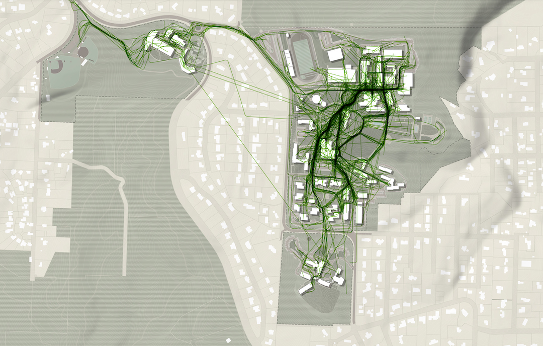
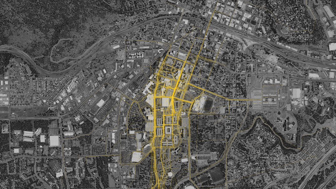
One of the main tools Sasaki uses to mitigate the informal desire path is a proprietary program developed by its in-house data and design tools group called CoMap. This collaborative mapping program generates a spatial visualization of how people experience a campus or region. When used at institutions, CoMap’s survey function allows campus communities to add notes about places or trace routes on a map of the campus. Sasaki then uses the data to inform planning recommendations.
“Many times the paths most traveled by students are not necessarily formally designed paths. The planning recommendation might therefore be to strengthen a desire line path by widening it, resurfacing it, removing an impediment, or lining it with active uses,” says Tyler Patrick, AICP, Principal, Chair of Planning and Urban Design on Board of Directors, and Planner with Sasaki. “For example, sometimes we find that service drives that are designed for vehicles are also heavily used by pedestrians, so we can instead redesign the path as more of a shared-use amenity, with aesthetic improvements to paving, lighting, etc.”
At one university, Sasaki used CoMap to learn that the formal entry to the campus was rarely used and the service drive actually served as the primary pedestrian route into campus. The design team took this information and reoriented the campus and created a new “front door” where the service drive used to be, with service access still accommodated, but in a more understated manner.
Sasaki also used CoMap in a master planning effort the firm led for Lewis & Clark College. The CoMap survey highlighted a strong north-south pedestrian route along an existing road. In response to the user feedback from CoMap, Sasaki turned the route into a primary pedestrian promenade on campus, surrounded by new residential and student life facilities.

CoMap is just one strategy the firm uses to create efficient plans without any informal desire paths. “We employ a range of strategies that include analyzing the existing system of pathways (what forms of mobility they support, their width, condition, amenities, etc.); collecting a variety of data (for instance, looking at where the concentration of classrooms is, as well as classroom utilization, to see key areas between which students may be moving); and conducting interviews and surveys to learn how pathways are used, deficiencies in the overall system, and desire paths that have not been formalized,” says Patrick.
Desire paths do not always equal good design
Just because an informal desire path appears, it does not mean it should always be formalized. Especially if the path is in direct conflict with the greater overall design scheme. “For instance, students may want to formally cross through a recreation field, but we want to maintain the field’s integrity for recreation and so we wouldn’t want to formalize that kind of desire path,” Patrick says.
Other instances may include environmental or safety concerns, such as wanting to keep a stream side riparian system intact as opposed to introducing formalized pedestrian pathways. “If a desire line promotes a path that isn’t accessible, we likely would not want to promote that movement,” adds Clauson.
The key is to balance how people want to use a given space without it turning into a free-for-all. Desire paths can, and often times do, suggest improvements for pedestrian circulation, but blindly formalizing any desire path can easily lead to a one step forward, two steps back situation. As Patrick said above, a desire path that cuts through a recreation field may prove that it is the most efficient way to traverse a campus, but formalizing it would certainly lead to more complaints about a now fractured field that is much more of an inconvenience than the lack of a formal path ever was.
As is often the case in modern design, the benefits of flexibility should never be understated. “A good campus plan should be flexible enough to accommodate evolving patterns of use and allow for the campus to integrate new ideas into the framework,” Patrick says.
The desire path, then, is representative of a larger point: There is no such thing as a perfect design, but there can be a perfectly adaptable one. Having the ability to continually adjust and formally adapt to the desires of end users is the best way to achieve the highest possible efficiency for any design.
Related Stories

| Feb 11, 2011
RS Means Cost Comparison Chart: Office Buildings
This month's RS Means Cost Comparison Chart focuses on office building construction.
| Feb 11, 2011
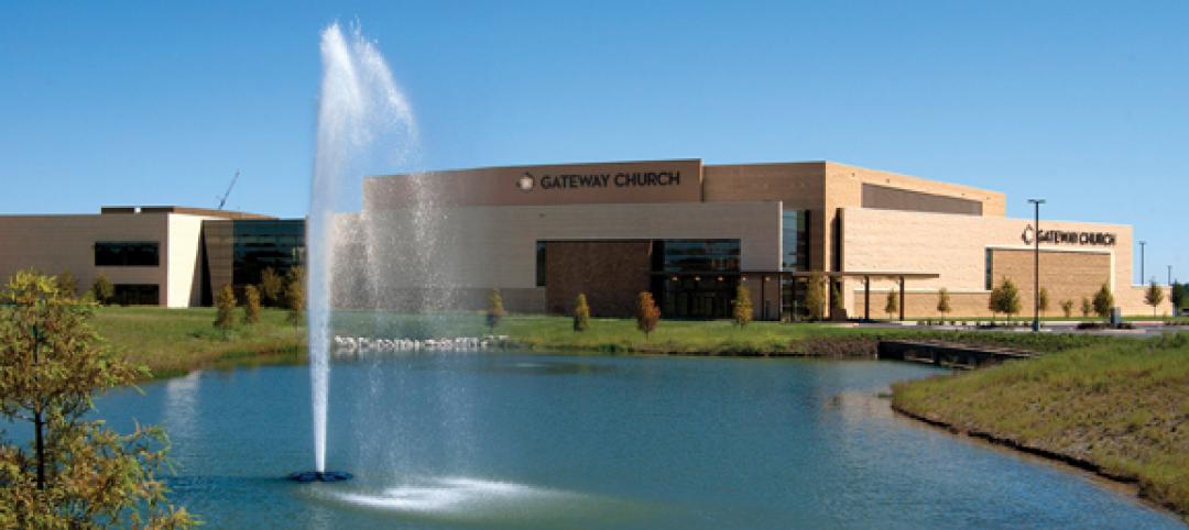
BIM-enabled Texas church complex can broadcast services in high-def
After two years of design and construction, members of the Gateway Church in Southland, Texas, were able to attend services in their new 4,000-seat facility in late 2010. Located on a 180-acre site, the 205,000-sf complex has six auditoriums, including a massive 200,000-sf Worship Center, complete with catwalks, top-end audio and video system, and high-definition broadcast capabilities. BIM played a significant role in the building’s design and construction. Balfour Beatty Construction and Beck Architecture formed the nucleus of the Building Team.
| Feb 11, 2011
Kentucky’s first green adaptive reuse project earns Platinum
(FER) studio, Inglewood, Calif., converted a 115-year-old former dry goods store in Louisville, Ky., into a 10,175-sf mixed-use commercial building earned LEED Platinum and holds the distinction of being the state’s first adaptive reuse project to earn any LEED rating. The facility, located in the East Market District, houses a gallery, event space, offices, conference space, and a restaurant. Sustainable elements that helped the building reach its top LEED rating include xeriscaping, a green roof, rainwater collection and reuse, 12 geothermal wells, 81 solar panels, a 1,100-gallon ice storage system (off-grid energy efficiency is 68%) and the reuse and recycling of construction materials. Local firm Peters Construction served as GC.
| Feb 11, 2011
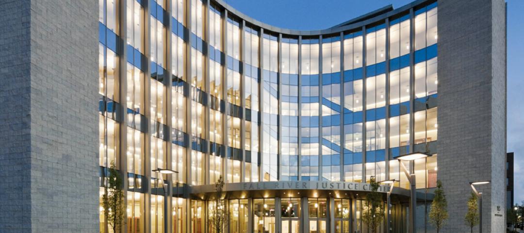
Justice center on Fall River harbor serves up daylight, sustainable elements, including eucalyptus millwork
Located on historic South Main Street in Fall River, Mass., the Fall River Justice Center opened last fall to serve as the city’s Superior and District Courts building. The $85 million facility was designed by Boston-based Finegold Alexander + Associates Inc., with Dimeo Construction as CM and Arup as MEP. The 154,000-sf courthouse contains nine courtrooms, a law library, and a detention area. Most of the floors have the same ceiling height, which will makes them easier to reconfigure in the future as space needs change. Designed to achieve LEED Silver, the facility’s elliptical design offers abundant natural daylight and views of the harbor. Renewable eucalyptus millwork is one of the sustainable features.

| Feb 11, 2011
Chicago high-rise mixes condos with classrooms for Art Institute students
The Legacy at Millennium Park is a 72-story, mixed-use complex that rises high above Chicago’s Michigan Avenue. The glass tower, designed by Solomon Cordwell Buenz, is mostly residential, but also includes 41,000 sf of classroom space for the School of the Art Institute of Chicago and another 7,400 sf of retail space. The building’s 355 one-, two-, three-, and four-bedroom condominiums range from 875 sf to 9,300 sf, and there are seven levels of parking. Sky patios on the 15th, 42nd, and 60th floors give owners outdoor access and views of Lake Michigan.
| Feb 11, 2011
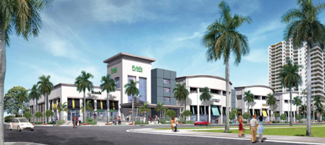
Grocery store anchors shopping center in Miami arts/entertainment district
18Biscayne is a 57,200-sf urban retail center being developed in downtown Miami by commercial real estate firm Stiles. Construction on the three-story center is being fast-tracked for completion in early 2012. The project is anchored by a 49,200-sf Publix market with bakery, pharmacy, and café with outdoor seating. An additional 8,000 sf of retail space will front Biscayne Boulevard. The complex is in close proximity to the Adrienne Arsht Center for the Performing Arts, the downtown Miami entertainment district, and the Omni neighborhood, one of the city’s fast-growing residential areas.

| Feb 11, 2011
Chicago architecture firm planning one of China’s tallest towers
Chicago-based Goettsch Partners was commissioned by developer Guangzhou R&F Properties Co. Ltd. to design a new 294,570-sm mixed-use tower in Tianjin, China. The Tianjin R&F Guangdong Tower will be located within the city’s newly planned business district, and at 439 meters it will be one of China’s tallest buildings. The massive complex will feature 134,900 sm of Class A office space, a 400-key, five-star hotel, 55 condominiums, and 8,550 sm of retail space. The architects are designing the tower with multi-story atriums and a high-performance curtain wall to bring daylight deep into the building, thereby creating deeper lease spans. The project is currently finishing design.
| Feb 11, 2011
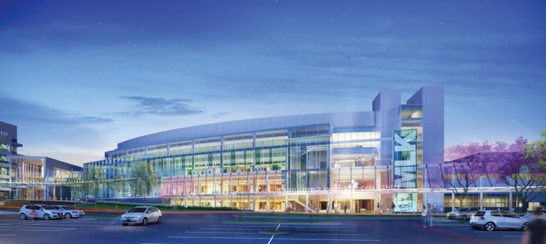
Two projects seek to reinvigorate Los Angeles County medical center
HMC Architects designed two new buildings for the Los Angeles County Martin Luther King, Jr., Medical Center as part of a $360 million plan to reinvigorate the campus. The buildings include a 120-bed hospital, which involves renovation of an existing tower and several support buildings, and the construction of a new multi-service ambulatory care center. The new facilities will have large expanses of glass at all waiting and public areas for unobstructed views of downtown Los Angeles. A curved glass entrance canopy will unite the two buildings. When both projects are completed—the hospital in 2012 and the ambulatory care center in 2013—the campus will have added more than 460,000 sf of space. The hospital will seek LEED certification, while the ambulatory care center is targeting LEED Silver.
| Feb 11, 2011
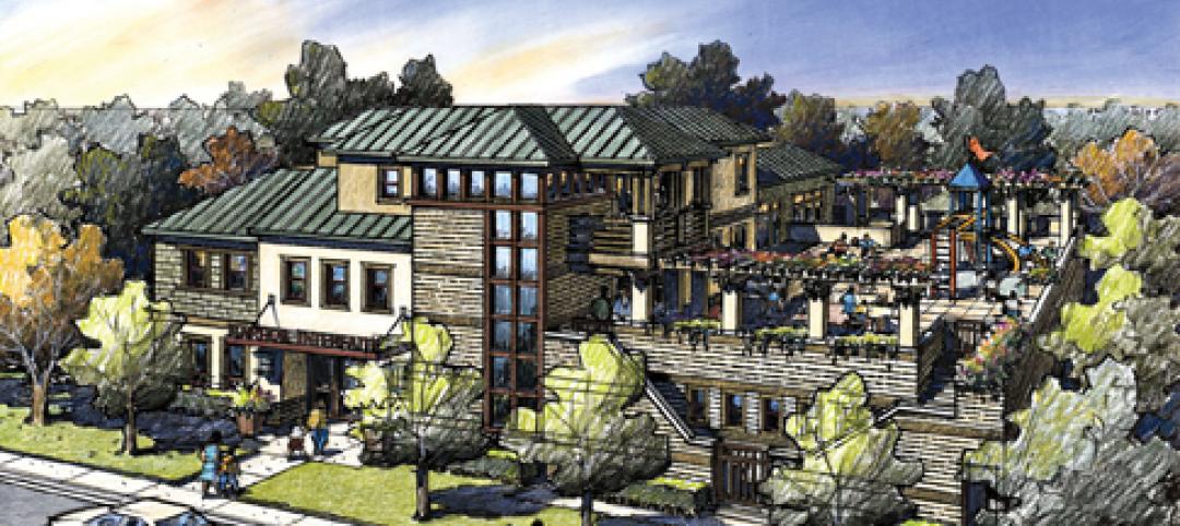
Sustainable community center to serve Angelinos in need
Harbor Interfaith Services, a nonprofit serving the homeless and working poor in the Harbor Area and South Bay communities of Los Angeles, engaged Withee Malcolm Architects to design a new 15,000-sf family resource center. The architects, who are working pro bono for the initial phase, created a family-centered design that consolidates all programs into a single building. The new three-story space will house a resource center, food pantry, nursery and pre-school, and administrative offices, plus indoor and outdoor play spaces and underground parking. The building’s scale and setbacks will help it blend with its residential neighbors, while its low-flow fixtures, low-VOC and recycled materials, and energy-efficient mechanical equipment and appliances will help it earn LEED certification.


