Moore's Law and the future of urban design
As planners and designers, we help shape the physical world—a process that increasingly requires digital software to enable our planning and design work. Combined with traditional methods of design, these computerized tools have allowed us to provide a higher level of service to our clients.
We can now understand site context through geographic information systems (GIS), track and analyze space data through building information modeling (BIM), and create 3D visualizations using programs such as SketchUp.
"As GPUs become even faster, planners and designers will be able to dream up complex digital environments and interact with them like never before. Combined with virtual reality tools, we will be able to immerse ourselves in these visions before they become reality."
These capabilities continue to evolve thanks to the exponential advancements in computer processor power. Recent headlines marked the 50th anniversary of Moore’s Law, acknowledging the accuracy of Gordon Moore’s prediction that both the price and performance of silicon processors are on a constantly doubling trajectory, becoming ever more affordable and powerful. This concept doesn’t stop with silicon transistors, but applies to computing in general, from early vacuum tube computers to today’s 3D processors.
This all raises the question: What will this mean for the future of our profession and how we shape the physical world? There are a variety of advancements on the horizon that could revolutionize how we design urban spaces in the future.
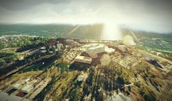
GPUs are specialized chips that enable the rendering of computer graphics. Their power allows us to visualize three dimensional environments with increasing levels of realism and complexity. Programs like Lumion 3D use the power of GPUs to render, in near real-time, detailed three-dimensional landscapes.
As GPUs become even faster, planners and designers will be able to dream up complex digital environments and interact with them like never before. Combined with virtual reality tools, we will be able to immerse ourselves in these visions before they become reality. We’ll walk down alternative city streets and stroll through conceptual building lobbies before construction drawings are even started.
Technology is also extending our reach by helping us understand existing site conditions. Quadcopters and drone technology are already being used to map and photograph property. Today it’s easier than ever to take aerial photographs of a site using this technology. In the future, drones will be equipped with computer vision capabilities, allowing them to generate three-dimensional models of real places literally on-the-fly.
All of these technologies have been enabled by the exponential advancements in computing power over the past 50 years. During the next 50, these advances will not only reshape how we design urban spaces but also how we experience them, as the digital and physical worlds become more and more entangled.
About the Author: Stephen Conschafter is an urban designer and planner with a deep interest in the design of campuses and urban spaces. He is particularly focused on how data, scientific metrics, and technology can be applied to site design and long range planning for cities and campuses.
